Poljcane

Road to Slovenske Bistrica

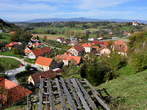
Central part of Poljcane

Crossing in Poljcane

Tus market Poljcane

Small park with the monument for the National Liberation War

Park in Poljcane

Road to Rogaska Slatina, Podcetrtek, Majsperk, Makole, etc.

Municipality building and the local office Poljcane

Shops along Bistriska cesta

Crossing of Bistriska and Dravinjska cesta

Post office Poljcane

Clinic Poljcane

Map - Educational trails and the classroom in the nature in the neighb...

Bistriska cesta

Development centre of nature

Boc Hill

Kindergarten Oton Zupancic Slovenska Bistrica - Unit Mehurcki

Railway station

Railway station Poljcane

Guest house Jug

Road to the railway station
Hotels, Apartments and Rooms
Data
Municipality: POLJČANE (4360 population)
Settlements in the municipality:
Poljčane (1110 population), Zgornje Poljčane (782), Spodnje Poljčane (603), Lušečka vas (261), Spodnja Brežnica (236),
Stanovsko (225), Novake (192), Čadramska vas (151), Studenice (134), Brezje pri Poljčanah (118), Hrastovec pod Bočem (105), Križeča vas (93), Globoko ob Dravinji (87), Ljubično (81), Krasna (75), Modraže (61), Lovnik (30), Podboč (16)
 KRAJI - Slovenia
 Slovenska BistricaSofia Holiday Haven in Nature with Pool