Source: Public information of Slovenia,
The Surveying and Mapping Authority of the Republic of Slovenia,
State map in measure 1 : 1.000.000, 1995
www.gu.gov.si
Recommended
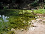
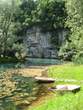
The Kamniska Bistrica mountain hut is located at the upper end of the Kamniška Bistrica valley and lies 13 kilometres from Kamnik. Several karstic springs of the river Bistrica flow nearby, which empty into a wonderful green lake. You can find two small donkeys, who love to be photographed and are an attraction for the children. You can also discover a playground and the beautiful renovated chapel of Lurska Marija. Originally, this was a hut converted from the Turistovska home in May 1909. This mountain hut has had its present form since 5 May 1929. After the Second World War it was managed by the Ljubljana Mountaineering Association and has been renovated, reorganized and modernized several times. The mountain hut is open from mid April to mid October, but it can also be opened for larger groups at other times. It has a wonderful view of the wreath of Kamnik Alps, which surrounds the valley. To the east is a view between the narrow valleys of Sedelscka and Kamniska Bela, the southern slopes of Rigeljc and Mešenik, to the Southeast of the valley lie the western slopes of Velika planina, to the south ther is a wide view of the eastern slopes of Mokrice from the Krvavec range, to the west, above the valley slopes is the Kalški crest. The most beautiful view is found to the Northwest of Kamnik Alps, where, behind the top most edge of Veliki Podi, Skuta, Struca, the Mlinarsko saddle and the top of Grintavec can be seen, to the North side of the valley is Southern Brana.
Source of the river Soca in situated in the Trenta valley (Zadnja Trenta). It belongs under community of Bovec. Under the first world war was valley the scene of a lot of battles. River Soca is 137 kilometres long river in north Italy and west Slovenia. It is also named Emerald River because of its wonderful crystal green colour. To visit the source of the river is best to begin in market path from Hut by source Soca which is the mountain post in Trenta. It is most easier approachable from the local road over mountain pass Vrsic. The hut was in the year 1953 reorganized from military building and was later renovated and expanded. It is open from beginning of May till end of October. To see the sight will take you about twenty minutes. The footpath is in good order and in upper part secured with wedges. It is suitable for visitors with proper shoes, but not recommended for children and olders, because of sliping. Karstic source is popular tourist point and it is most beautiful in spring and summer time. Waters in the height 1100 metres highly boil up on day from cave with underworld small lake and through narrow gorge, which is soon broaden. Beside source of the river Soca also begins 20 kilometres long educational footpath. The river flows against south and near Trst in Italy falls into the Adriatic Sea. Snita is the old name for river Soca.
The Savica Waterfall is a wonderful waterfall in Bohinj valley. The best way to come to the waterfall is from the parking place by Koca pri Savici and Home Savica. We come there from Ukanc. Passing the Home Savica we follow the information sighns to the stony bridge over the Mala (Little) Savica. Here we pay in the wooden cottage contribution for maintenance of the road and we can also buy souvenirs. After that we continue the way after the stony stairs to the small wooden hut. Time of walking is about 20 minutes. In the cottage is a view to the Savica Waterfall, Bohinj and Vogel. Waterfall Savica is most visited and very well known Slovenian waterfall. The largest stream is in spring and autumn. The waterfall had celebrated in the poems the greatest Slovenian poet, France Preseren. Waterfall Savica is two part waterfall, which is in the shape of letter A. The smaller waterfall falls in the pool 25 metres deep. The height of the bigger side is about 78 metres. The Savica brook has two parts, which are Mala (Little) Savica and Velika (Great) Savica, on which is the Savica Waterfall. We can come to the waterfall also, if we turn right by the Koca pri Savici, but from this side is not so marvellous view.
Other
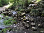
The Spring of Glijun is situated near Bovec. In the centre of Bovec you go to Kanin village, where you drive past and after about 3 kilometres you will come to the village Pluzna. You can park car here and walk by road or you drive about 500 metres forward and park car by the road in the wood. After the path left, where is the direction table, you can also go to the Virje Waterfall. You have to continue the trail straight on for the Spring of Glijun and you will come to the bridge over the Glijun Brook, which offers the brave one pleasant refreshment in the summer times. After the 100 metres of walking you will come to the dike and from there you can see the Spring of the Glijun Brook. The brook is the karstic spring of the Kanin waters. The Glijun Brook flows to the earth from many bigger and smaller springs. The spring has the average temperature 5,5 C.
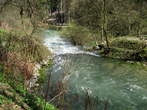
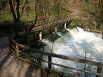
The source of Hubelj is located about three kilometers from Ajdovscina. The Hubelj River boils daily from numerous holes in the Karst underground that are more or less accessible. The source is especially interesting with the high water that falls from the higher vault in the mighty waterfalls.
View of the splashed water as the drops come from an altitude of about 240 meters to the bridge, which is 40 feet lower, is wonderful. The waters from the underground flow through three caves, which are the Spider Network, the Great Hubel Cuisine and the Eastern Hubel Cave. During the dry season, about 400 trenches were measured, ending with siphon rolls and piles. Hubelj Spring is one of the main karst springs in the Vipava Valley, also important for its integrity and purity, as it is one of the most potable waters in the valley. In the 16th and 17th centuries, iron smiths and iron foundations operated along the upper course of Hubble. At the time, Hubble was developing into an industrial center, which was the birthplace of today's buckwheat industry. At the time, Hubble was developing into an industrial center, which was the birthplace of today's buckwheat industry. At that time near Hubble an industrial center was being developed, which was the origin of the present-day buckwheat industry. Near the spring is located Guest house Gostilna pri izviru Hublja, where guests can enjoy delicious food and refreshing tea. From Pale Sports Park to the source of Hubelj leads a beautifully arranged Naturalistic Educational Trail.
At the 3,100-meter-long path, you learn more about the basic natural laws through 24 stations. You learn about typical rocks, tree species, shrubs, forest animals, aquatic ecosystems and other peculiarities and characteristics of nature.
The iron water spring is located under Olseva. Olseva is a mountain, which is part of the Karavanke range and closes the Solcava area from the north side. The spring is just few meters away from the main road, if we go from the Logar Valley to Podolseva. The road which connects the Logar Valley with Podolseva is because of the wonderful views called the Panoramic Road. The iron water spring was formed by the tectonic shift that separated the Savinja Alps from Karavanke. The water is rich with the carbon dioxide, iron and other. The iron is very important element in the human body. The iron deficiency causes the anaemia, which is accompanied with a lack of enery, tiredness, breathlessness and other. The surrounding of the spring covers the sediment, which is a reddish brown colour. The iron water spring was proclaimed for a natural monument. Podolseva is a village, which belongs to the highest lying in Slovenia. The centre of the village is the Church of the Holy Spirit in which we can see a gothic goblet, bell and interesting relief of the Holy Spirit. The village is a starting point to Potocka Zijalka Cave and to the top of the Olseva mountain.
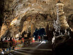
The River Krka springs in the Krka Cave in the 268 height above see level and then it flows into the river Sava at Brezice. To the spring you can come after the pleasant walk throug the village Gradicek. The Karst spring is under the rock, where is the the entrance to the original Krka Cave. The examination of the cave is possible only with the tourist guide, which will accept you before entering to the cave. The cave is open from April to October. For the public was opened by the Tourist association Krka in the year 1996. The Krka Cave is 200 metres long and wide about 30 metres. The chamber is concluded with the 30 metres long siphon lake. The siphon goes after the 210 metres into the spacious, 60 metres long final cave. The common length of the researched tunnels is about 490 metres. It is the horizontal cave, from which vomits the underworld water only by overflowing. The floors are covered with large boulders and rubble, which are in the eastern part piled up all to the stamp. In the cave is the constant inhabitant the human fish. The Krka Cave was sometimes the shelter for the local people. About that wrote Josip Jurcic in his novel Jurij Kozjak. The first one, who put down the visit of the Krka Cave, was Janez Vajkard Valvasor in the second part of the 17th century. The first plan of the Krka Cave was made in the year 1887 by V. Hrasky. The main entrance was wide open in the year 1937, so that they could made possible the faster outflow of the underworld water and so save the problem with the floods in Radenska field. The cave divers have only in the year 1995 swam across the labyrinth of the underwater tunnels and broke through the final Vrhoved chamber. River Krka is the longest and completely Slovenian river. It has 94 kilometres of surface stream and rainy – snowy regime with the highest water in autumn and the lowest in summer. It’s river basin is extended over the 2284 square kilometres. Krka River is the only tufa producing river. Its water is saturated with the limestone, which from the village Marinca to Otocec eliminates like tufa and forms the characteristic barriers and thresholds. In the past there were numerous mills and saws, but today is prevailing more the recreative and tourist meaning of the river. Particulary is attractive for kayaking and fishing. Because of the pollution waters in the Karst hinterland is the Krka River already by the source ranged to the second quality rank. Its quality goes worse in the middle and lower stream, where is in the second and third rank. Above the village Gradicek is located the Poltarica Cave, the neighbour of the Krka Cave, which was uncovered in the year 2003. The cave is above the source of Poltarica, the first afflux of the Krka River. It is ornamented with many stalactites, curtains, tubes, five siphon lakes, human fishes and rapids. Poltarica Cave is not open for tourists, but you can see it in the attendance of the cavers.
 KRAJI - Slovenia
 Kranjska GoraMilka Boutique Hotel