 PrevaljeKmetija Pečnik


Gorizia Region









 Triglav National Park
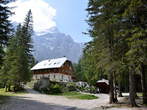
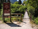
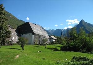
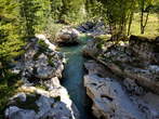
The Triglav National Park is situated in the northwestern part of Slovenia, just by the Italian border and close to the Austrian border. Its territory is almost the same with that occupied by the Eastern Julian Alps. The Triglav National Park is the only national park in Slovenia. The park was named after Triglav, which is the highest mountain in Slovenia (2864 m). The lowest surface point in the national park is in the Tolmin Gorge (180 m).
The Triglav National Park covers 880 square kilometres, which is 3 % of the territory of Slovenia. The park is among the earliest European parks, the first protection goes back to the year 1924 when the Alpine Conservation Park was founded. The main task of the Triglav National Park Public Institution is the protection of the beautiful park, but it also carries out research and specialist tasks.
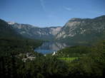
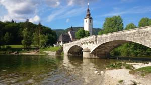
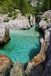
In the Triglav National Park is the largest lake named Bohinj Lake, which also the largest permanent lake in Slovenia. The Triglav National Park offers visitors amazing natural beauty and cultural heritage, where it is recommended to visit the following places: Bohinj with the lake, Vintgar Gorge, the highest Slovenian mountain pass Vrsic, Vrata Valley with the Pericnik Waterfall, Trenta Valley with the emerald Soca River, Tolmin Gorge and many other places of pristine beauty.
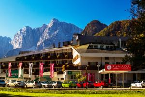
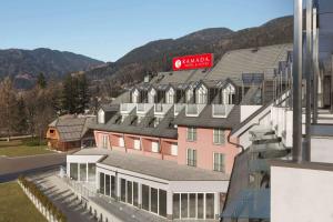
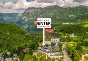
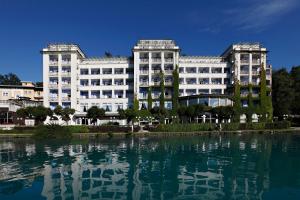
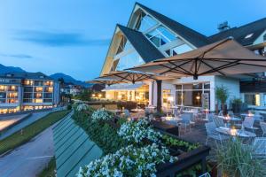
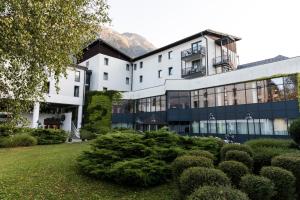
As a starting point to the Triglav National Park are recommended accommodations in the following towns: Bled, Bohinj, Kranjska Gora, Mojstrana, Bovec etc., where are hotels, apartments, private rooms, campsites and the mountain huts at the walking paths. In Kranjska Gora visitors can enjoy in the Hotel Larix, Grand Hotel Prisank, Penzion Livada and a great many apartments. In Bohinj are available the Hotel Center, Hotel Jezero, Pension Bohinj, Hostel Bohinj, Hotel Bohinj Park and others. Besides the Bohinj Lake is also a Zlatorog Camp. In Bled are available the Grand Hotel Toplice with five stars, Hotel Park, Hotel Kompas, Bled Backpackers Hostel, ACE Apartments Bled, Aparthostel Tina and others. In Bovec visitors can enjoy in the Hotel Alp, Hotel Kanin, Hotel Mangart, Adrenaline-Check Open Air Hostel Soca, Apartments Kaninska Vas, Penzion Boka and many others.
The Triglav National Park covers 880 square kilometres, which is 3 % of the territory of Slovenia. The park is among the earliest European parks, the first protection goes back to the year 1924 when the Alpine Conservation Park was founded. The main task of the Triglav National Park Public Institution is the protection of the beautiful park, but it also carries out research and specialist tasks.
In the Triglav National Park is the largest lake named Bohinj Lake, which also the largest permanent lake in Slovenia. The Triglav National Park offers visitors amazing natural beauty and cultural heritage, where it is recommended to visit the following places: Bohinj with the lake, Vintgar Gorge, the highest Slovenian mountain pass Vrsic, Vrata Valley with the Pericnik Waterfall, Trenta Valley with the emerald Soca River, Tolmin Gorge and many other places of pristine beauty.
As a starting point to the Triglav National Park are recommended accommodations in the following towns: Bled, Bohinj, Kranjska Gora, Mojstrana, Bovec etc., where are hotels, apartments, private rooms, campsites and the mountain huts at the walking paths. In Kranjska Gora visitors can enjoy in the Hotel Larix, Grand Hotel Prisank, Penzion Livada and a great many apartments. In Bohinj are available the Hotel Center, Hotel Jezero, Pension Bohinj, Hostel Bohinj, Hotel Bohinj Park and others. Besides the Bohinj Lake is also a Zlatorog Camp. In Bled are available the Grand Hotel Toplice with five stars, Hotel Park, Hotel Kompas, Bled Backpackers Hostel, ACE Apartments Bled, Aparthostel Tina and others. In Bovec visitors can enjoy in the Hotel Alp, Hotel Kanin, Hotel Mangart, Adrenaline-Check Open Air Hostel Soca, Apartments Kaninska Vas, Penzion Boka and many others.
Recommended
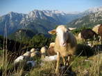
Mangart is 2679 meters high mountain in Julian Alps. It is the fourth highest mountain in Slovenia. It lies on the border with Italy, so it attracts many mountaineers from both countries. We can come to Mangart Saddle from different directions: from direction Lake Predil (Trieste), from direction Trenta (Vrsic) or from direction Bovec. Branch for the road to Mangart Saddle is in the nearness of the new viaduct, which is situated on the way between border crossing Predel and Log pod Mangartom. The old military road drives us to Mangart Saddle, which lies 2055 meters above sea level and it is a starting point for hiking to Mangart. The road is steep, winding and in some parts little exposed. We drive through several tunnels. Driving in this road is a wonderful experience. On the way we can stop on resting places. It was built in the year 1983. We have to pay to use the road. During driving we have magnificent views to near and distant neighbourhood. The road is an attractive destination for cyclists and motorcyclists. It is the most beautiful mountain road in Slovenia. On the way to Mangart Saddle we can see sheep in the summer time and it becomes the paradise for lovers of sledding in the winter time.
Other


Fort Hermann is part of the stronghold complex of the Kluze Fortress. It was built in the rising ground above the Kluze Fortress. The beginning of the trail is in the nearness of the Kluze Fortress, at the opposite side of the road. Under the steep walls, where the rocks can fall, you will come to the tunnel. The tunnel has lighting and when you walk through, are by side the corridors, which lead to the shooting lines. They started to built the tunnel and the accessible road already in the year 1897. The work was done under the Austrian imperial – royal military construction leadership, which had seat in Bovec and was ended till the year 1906. The tunnel was in The First World War equipped with the three hidden lines, which are still seen now. To the Fort Hermann leaded also the steep trail on the transversal wedges. Today is the trail to the fortress directed with signboards. When you come to the Fort Hermann, you will stop breathing because of its greatness, in spite of that it is very ruined of the passed time. It got the name after the captain Johann Hermann von Hermannsdorf. He was the commander of the Predel fortress in the time of the Napoleon wars. It was built in the year 1900, so that it would support the Kluze Fortress. It was one of the six Carinthia's fortresses. It is also known as the upper Kluze Fortress. The fortresses were protecting the access to Trbiz and to the hinterland of the Austria. In the First World War the Fort Hermann was destroyed by the first greater Italian bombardment and it was not in use till today. You can only see the ruins of the building. In the fortress is standing the information table. You can go by the new stairs to three galleries below Fort Hermann.
Source of the river Soca in situated in the Trenta valley (Zadnja Trenta). It belongs under community of Bovec. Under the first world war was valley the scene of a lot of battles. River Soca is 137 kilometres long river in north Italy and west Slovenia. It is also named Emerald River because of its wonderful crystal green colour. To visit the source of the river is best to begin in market path from Hut by source Soca which is the mountain post in Trenta. It is most easier approachable from the local road over mountain pass Vrsic. The hut was in the year 1953 reorganized from military building and was later renovated and expanded. It is open from beginning of May till end of October. To see the sight will take you about twenty minutes. The footpath is in good order and in upper part secured with wedges. It is suitable for visitors with proper shoes, but not recommended for children and olders, because of sliping. Karstic source is popular tourist point and it is most beautiful in spring and summer time. Waters in the height 1100 metres highly boil up on day from cave with underworld small lake and through narrow gorge, which is soon broaden. Beside source of the river Soca also begins 20 kilometres long educational footpath. The river flows against south and near Trst in Italy falls into the Adriatic Sea. Snita is the old name for river Soca.


The military cemetery of the fallen soldiers in the World War I is marked with the table and is situated near main road to Log pod Mangrtom. Near the cemetery is a small chapel. At the World War I Military Cemetery is in four terraces buried 859 Austo – Hungarian soldiers, fallen in the fights in Rombon and Cukel. In the middle of the of the cemetery is erected the monument of the fallen soldiers with the image of the Bosnian and Austrian soldiers. The monument was made by Ladislav Kofranek from Prague. The tombstones are separated with iron crosses and Islamic tombstone symbols.
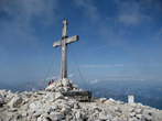
Mangart is 2679 meters high mountain in Julian Alps. It is the fourth highest mountain in Slovenia. It lies on the border with Italy, so it attracts many mountaineers from both countries. The starting point to Mangart is the Mangart Saddle, which is situated on the 2055 meters above sea level. Up to there will drive you the picturesque former military road, which was built in the year 1938. In the saddle is the mountain hut, where they have delicious Slovenian food. It is open from July till September. The Mangart Saddle is a popular place for gliding parachutists. From there we can see Mangrt Lake. There are two main paths to the Mangart, Italian and Slovenian Way. Italian Path is gently sloping, easier and it takes about two hours. Slovenian Path goes by western wall and it is more difficult. It takes about one hour and half. It is necessary that we have helmet and other proper equipment. Mangart is famous by geological and botanical specialities. It is the only habitant for some rare plants. From the spacious summit is the unforgettable view to Julian Alps with neighbourhood places like Trbiz, Log pod Mangartom, Predil and Lake Valley with Lake Predil (Lake Raibl).

Mangart is 2679 metres high mountain in Julian Alps. It is the fourth highest mountain in Slovenia. It lies on the border with Italy, so it attracts many mountaineers from both countries. The starting point to Mangart is the Mangart Saddle, which is situated on the 2055 meters above sea level. There is no special parking place, but we can park cars on many places along the road where is enough space. Up to there goes the picturesque former military road, which was built in the year 1938. The road is steep, winding and in some parts little exposed. We drive through several tunnels. Driving on this road is a wonderful experience. On the way we can stop on resting places. On the saddle is the mountain hut, where you can get delicious Slovenian food. It is open from July till the end of September. Koca na Mangrtskem sedlu Mountain Hut was opened in the year 1938. The Mangart Saddle is a popular place for gliding parachutists. It is possible to see Mangart Lakes from the Mangart Saddle. We can see Mangart Lake. There are two main paths to the Mangart, Italian and Slovenian Way. Italian Path is gently sloping, easier and it takes about two hours. Slovenian Path goes by western wall, it is more difficult and it takes about one hour and half.
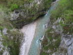
Tolmin is the central point of the Tolmin landscape. It is situated on the balcony between rivers Tolminka and Soca. The city was between first world war, when in the nearness were taking place Soca fronts, very much demolished. In this place are the most remarkable river beds of Tolminka and Zadlascica. Tolmin river beds are the most southern entrance point to Triglav National Park, which is the only Slovenian national park. The road goes from Tolmin and one kilometre to Zatolmin. Tolmin gorge is the most important natural remarkableness. Tourist paths were built from the years 1953 to 1958. They go along Tolminka to the thermal spring and by Zadlascica to Bear’s Head. The main keeper of the road is the Tourist association Tolmin. On the entrance point visitors can buy admission ticket, receive the map of the road and all other important information. The circular trail goes to the confluence Zadlascica and Tolminka, from there to Bear’s Head, by the road Zatolmin – Cadrg to the entrance into Dante’s or Zadlaska Cave. The cave is named by the village Zadlaz. The other name got by the poet Dante Alighieri who perhaps in the beginning of the 14th century visited the cave and in this environment found the inspiration for The Hell in his poem Divine comedy. The Bear's Head is called the natural bridge, the large rock, which had over the centuries wedged between the walls of the canyon Zadlascica. You can return by the road and go across the Devil's Bridge, which was built in the year 1907. At the beginning was wooden, but later was exchanged with iron construction. From this place is a beautiful view to the Tolmin gorge, which was through the centuries shaped by the river Tolminka.
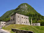
Kluze Fortress is situated near Bovec. It belongs to the most powerful and most interesting strongholds. It is lying above the deep gorge of the Koritnica River, in its most narrow part. Before the Kluze Fortress is a small park, where are also the information tables. The primary Venetian fortress was erected in the second part of the 15th century for defence before the Turks. The Venetians were banished away in the year 1509 and the Kluze fortress came into the Austrian possession. It was strengthen at the expense of the Carinthia provincial States and it became the seat of the district. In the second part of the 17th century the governor general of a province Georg Filip von Gera took care for the necessary improvement and completed it. The Kluze Fortress played the important role in the French wars. It was burnt down and destroyed in the year 1797. In the years from the 1881 to 1882 the remains were pulled down and they built the new fortress in the same place. Between the First World War was here the seat of the Austro – Hungarian garrision close behind the front line. After the Second World War it lost its rule and was left to the time. Between the years 1987 and 1991 they protected the roof construction and put in order the surroundings. Inside of the fortress is presented the history of the fortress and its surroundings, the smaller tourist office, wedding hall and local painting gallery. They regularly perform the games of soldiers, which are dressed in uniforms and with the equipment from the period of the First World War. Before the fortress in the direction of Bovec you can see The Castle Well from the year 1670, which is cut in the rocks. In the well was flowing the rainwater. Before that they carried the water from Koritnica River.

Natural Sights/Attractions
Beaches
Caves
Gorges
Karavanken
Lakes
NP Triglav
Parks
Rivers
Sources
Waterfalls
Cultural-Historical Sights/Attractions
Basilicas
Castles
Cemeteries
Cities
Monasteries
Monuments
Museums
Old Towns
Town Halls
Other
Camps
Places for Wedding
Ports
Ski Slopes
Spas
Toboggan Runs