 KRAJI - Slovenia


 | Fortification Goli vrh |
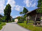
 | Gorenja vas - Church of the martyrdom of John the Baptist |
 | Hotavlje |
 | Gorenja vas - Nesko's wooden footbridge and Poljanska Sora |
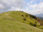 | Blegos |
 | Bunker Goli vrh |


| Fortification Goli vrh |
| Gorenja vas - Church of the martyrdom of John the Baptist |
| Hotavlje |
| Gorenja vas - Nesko's wooden footbridge and Poljanska Sora |
| Blegos |
| Bunker Goli vrh |
Photo: 660-0
Photo: 660-1
Photo: 660-2
Photo: 660-3
Photo: 660-4
Photo: 660-5
Photo: 660-6
Photo: 660-7
Photo: 660-8
Photo: 660-9
Photo: 660-10
Photo: 660-11
Photo: 660-12
Photo: 660-13
Photo: 660-14
Photo: 660-16
Photo: 660-17
Photo: 660-18
Photo: 660-19
Photo: 660-20
Photo: 660-21
Photo: 660-22
Photo: 660-23
Photo: 660-24
Photo: 660-25
Photo: 660-26
Photo: 660-27
Municipality: GORENJA VAS - POLJANE (7541 population)
Settlements in the municipality:
Gorenja vas (1149 population), Poljane nad Škofjo Loko (471), Hotavlje (452), Hotovlja (249), Stara Oselica (217),
Trebija (209), Podgora (206), Javorje (199), Dolenja Dobrava (186), Sovodenj (181), Lučine (175), Podjelovo Brdo (148), Delnice (145), Gorenja Dobrava (144), Predmost (141), Žirovski Vrh Sv. Urbana (140), Brebovnica (133), Srednja vas - Poljane (122), Volča (117), Srednje Brdo (113), Dobje (110), Fužine (107), Dobravšce (105), Volaka (100), Bukov Vrh (97), Gorenje Brdo (91), Leskovica (88), Dolenje Brdo (85), Dolenčice (83), Prelesje (76), Laniše (71), Hlavče Njive (70), Kopačnica (70), Murave (66), Hobovše pri Stari Oselici (66), Dolge Njive (64), Kladje (63), Vinharje (62), Podobeno (60), Gorenja Žetina (59), Zadobje (55), Žirovski Vrh Sv. Antona (54), Čabrače (54), Malenski Vrh (53), Suša (51), Četena Ravan (51), Podvrh (50), Žabja vas (49), Lom nad Volčo (48), Goli Vrh (45), Dolenja Žetina (43), Zakobiljek (41), Smoldno (36), Mlaka nad Lušo (35), Debeni (34), Krnice pri Novakih (32), Lovsko Brdo (31), Studor (30), Zapreval (30), Laze (26), Jarčje Brdo (24), Bačne (22), Dolenja Ravan (19), Todraž (19), Kremenik (18), Robidnica (16), Nova Oselica (16), Jazbine (14), Javorjev Dol (13), Lajše (13), Jelovica (10), Gorenja Ravan (10), Krivo Brdo (9)


")


")


