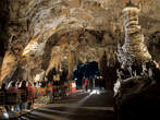
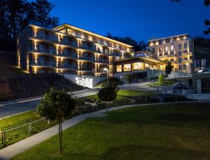
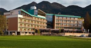
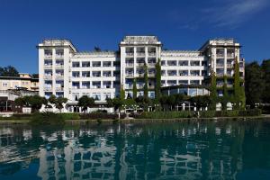
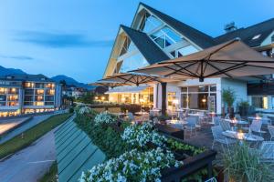
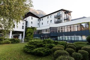
 Rogaška SlatinaAtlantida Boutique HotelRogaška SlatinaAtlantida Boutique Hotel
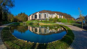 PodčetrtekTerme Olimia - Aparthotel Rosa
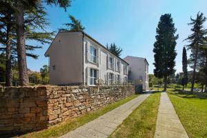 AnkaranVillas - Hotel & Resort Adria Ankaran
Slovenia
Slovenia is a European country between Alpes, Adriatic Sea and Pannonian Basin.









 Triglav National Park
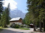
The Triglav National Park is situated in the northwestern part of Slovenia, just by the Italian border and close to the Austrian border. Its territory is almost the same with that occupied by the Eastern Julian Alps. The Triglav National Park is the only national park in Slovenia. The park was named after Triglav, which is the highest mountain in Slovenia (2864 m). The lowest surface point in the national park is in the Tolmin Gorge (180 m).
The Triglav National Park covers 880 square kilometres, which is 3 % of the territory of Slovenia. The park is among the earliest European parks, the first protection goes back to the year 1924 when the Alpine Conservation Park was founded. The main task of the Triglav National Park Public Institution is the protection of the beautiful park, but it also carries out research and specialist tasks.
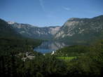
In the Triglav National Park is the largest lake named Bohinj Lake, which also the largest permanent lake in Slovenia. The Triglav National Park offers visitors amazing natural beauty and cultural heritage, where it is recommended to visit the following places: Bohinj with the lake, Vintgar Gorge, the highest Slovenian mountain pass Vrsic, Vrata Valley with the Pericnik Waterfall, Trenta Valley with the emerald Soca River, Tolmin Gorge and many other places of pristine beauty.
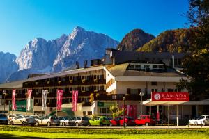
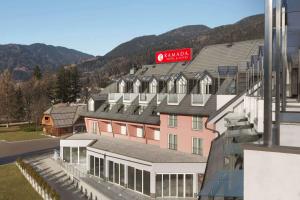
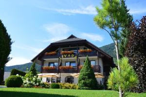
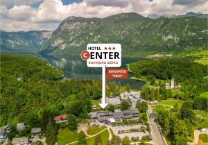
As a starting point to the Triglav National Park are recommended accommodations in the following towns: Bled, Bohinj, Kranjska Gora, Mojstrana, Bovec etc., where are hotels, apartments, private rooms, campsites and the mountain huts at the walking paths. In Kranjska Gora visitors can enjoy in the Hotel Larix, Grand Hotel Prisank, Penzion Livada and a great many apartments. In Bohinj are available the Hotel Center, Hotel Jezero, Pension Bohinj, Hostel Bohinj, Hotel Bohinj Park and others. Besides the Bohinj Lake is also a Zlatorog Camp. In Bled are available the Grand Hotel Toplice with five stars, Hotel Park, Hotel Kompas, Bled Backpackers Hostel, ACE Apartments Bled, Aparthostel Tina and others. In Bovec visitors can enjoy in the Hotel Alp, Hotel Kanin, Hotel Mangart, Adrenaline-Check Open Air Hostel Soca, Apartments Kaninska Vas, Penzion Boka and many others.
The Triglav National Park covers 880 square kilometres, which is 3 % of the territory of Slovenia. The park is among the earliest European parks, the first protection goes back to the year 1924 when the Alpine Conservation Park was founded. The main task of the Triglav National Park Public Institution is the protection of the beautiful park, but it also carries out research and specialist tasks.
In the Triglav National Park is the largest lake named Bohinj Lake, which also the largest permanent lake in Slovenia. The Triglav National Park offers visitors amazing natural beauty and cultural heritage, where it is recommended to visit the following places: Bohinj with the lake, Vintgar Gorge, the highest Slovenian mountain pass Vrsic, Vrata Valley with the Pericnik Waterfall, Trenta Valley with the emerald Soca River, Tolmin Gorge and many other places of pristine beauty.
As a starting point to the Triglav National Park are recommended accommodations in the following towns: Bled, Bohinj, Kranjska Gora, Mojstrana, Bovec etc., where are hotels, apartments, private rooms, campsites and the mountain huts at the walking paths. In Kranjska Gora visitors can enjoy in the Hotel Larix, Grand Hotel Prisank, Penzion Livada and a great many apartments. In Bohinj are available the Hotel Center, Hotel Jezero, Pension Bohinj, Hostel Bohinj, Hotel Bohinj Park and others. Besides the Bohinj Lake is also a Zlatorog Camp. In Bled are available the Grand Hotel Toplice with five stars, Hotel Park, Hotel Kompas, Bled Backpackers Hostel, ACE Apartments Bled, Aparthostel Tina and others. In Bovec visitors can enjoy in the Hotel Alp, Hotel Kanin, Hotel Mangart, Adrenaline-Check Open Air Hostel Soca, Apartments Kaninska Vas, Penzion Boka and many others.
Recommended
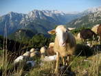
Mangart is 2679 meters high mountain in Julian Alps. It is the fourth highest mountain in Slovenia. It lies on the border with Italy, so it attracts many mountaineers from both countries. We can come to Mangart Saddle from different directions: from direction Lake Predil (Trieste), from direction Trenta (Vrsic) or from direction Bovec. Branch for the road to Mangart Saddle is in the nearness of the new viaduct, which is situated on the way between border crossing Predel and Log pod Mangartom. The old military road drives us to Mangart Saddle, which lies 2055 meters above sea level and it is a starting point for hiking to Mangart. The road is steep, winding and in some parts little exposed. We drive through several tunnels. Driving in this road is a wonderful experience. On the way we can stop on resting places. It was built in the year 1983. We have to pay to use the road. During driving we have magnificent views to near and distant neighbourhood. The road is an attractive destination for cyclists and motorcyclists. It is the most beautiful mountain road in Slovenia. On the way to Mangart Saddle we can see sheep in the summer time and it becomes the paradise for lovers of sledding in the winter time.
The Pericnik Waterfall is one of the most well known waterfalls in Slovenia. It consists of the Upper and Lower waterfall. The Upper waterfall is high about 16 meters and the Lower waterfall is high about 52 meters. The maximum water flow is in autumn and in spring time. In winter time both waterfalls turn into innumerable floes and icicles in delicate shades of green and blue. Near the waterfall is a mountain hut called Koca pri Pericniku. The Pericnik Waterfall was created as a result of glacial activity in the Vrata Valley. During the retreat of the glaciers, glacial material was carried away by water and deposited further down the valleys. In Vrata, deposited material formed a conglomerate rock face which runs along the left bank of the Triglavska Bistrica river, stretching up to 100 meters in width. The conglomerate cliff is best seen in the location of Pericnik Fall, dropping over its rim. The fall's course changed several times. Above the Lower Pericnik Waterfall, the Upper Pericnik Waterfall also cut its way across the rim.
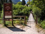
The Vintgar Gorge is situated in the road from the Bled over Spodnje Gorje, Podhom and the small village Vintgar. We can park car before the gorge, there is a big parking place. The Blejski Vintgar Gorge is open from the end of the April till the end of October but it depends on the weather situation. The gorge is open from eight to seven in the afternoon. It was discovered in the year 1891 by photograph Benedikt Lergetporer and Jakob Žumer, mayor of Gorje village and cartographer. For tourist visit the gorge was open in the year 1893. The paths were from that time frequently renovated. The Vintgar Gorge is 1,6 kilometres long. Through the gorge flows the wonderful greenish Radovna River with the pools, waterfalls, rapids and roaring, which is echoing over the narrow passages. The height of the slope is 250 metres. In some places is protected with the nets. The path leads us across the wooden bridges and so called Zumer gallery. Necessary is to have good sport shoes, because in some places is the path slippery and dangerous. The river beds crosses the railway line Jesenice – Most na Soci. At the end we can see the powerful Sum Waterfall, about 15 metres high, which is one of the rare Slovenian river waterfalls. Here is also the barrage for the hydroelectric station Vintgar. We can refresh and recover at the beginning of the gorge or at the waterfall Sum. In both places are small cafes. We can go back at the same way or over the Hom to Sveta Katarina, where is a historical church and wonderful view to Karavanke and Bled with surroundings. For walking and return with photographing and viewing we need about one hour and half. The Vintgar Gorge is exceptional beautiful and worth seeing. In summer months is pleasantly cool.
Triglav is the highest mountain in Slovenia and the central part of Triglav National Park. Triglav is 2864 metres high and is located in the Julian Alps. It is a symbol of Slovenia and we can see it in the Slovenian arms. The first one who climbed to the mountain in the year 1778 were Luka Korosec, Stefan Rozic, Matevz Kos and Lovrenc Willomitzer from Bohinj, where we also can see their monument. In the year 1895 was built Aljaz's Tower by Jakob Aljaz, the parish priest in Dovje. In the case of bad weather can be in the tower 5 people. Aljaz's Tower is protected as the cultural monument. Jakob Aljaz also made the Stanic shelter, which is located just above the Triglav summit. We can come to Triglav from different ways and the easiest is from Krma or Pokljuka. The time of walking is from 6 to 8 hours, depending on our condition and the way of beginning. One of the difficult climbing ways is the Triglav northern rock wall. From the summit of Mt. Triglav is a nice view to Julian Alps and other more distant peaks. In sunny weather we can also see the Adriatic sea.
Other


The Church of the Holy Spirit is situated on the southern side of the Bohinj Lake, close to the main road Ribcev Laz – Ukanc. The Church of the Holy Spirit was built in the year 1743 in the baroque style. It is 16 metres long and 8 metres wide. The choir is built of stones and the bell tower was constructed in the same year as the church. Both, the church and the bell tower have a shingle roof. The whole church is white painted, with 12 frescoes discovered during the renovation in 1981. On the northern side a special depository was added as a place to store wheat and other donations offered by people on votive Wednesdays, and especially on Thanksgiving Sunday when there is a Holy Mass. The church has three altars. The main altar is wooden with illustrious Trinity statue. The lateral statues are Saint Helen and Saint Agnes. The right side altar opposite the pulpit side is dedicated to St. John Nepomuk. The altar is built of stone, with a wooden prolongation. The second, left side altar is St. Francis Xavier's. Also this altar is built of stone, with a wooden prolongation. On the outer side of the eastern presbyterian wall is a large painting of St. Christopher, painted over the whole wall. Originally there were three bells, however only the middle one survived the First World War. It is made of bronze and weights 250 kg. The bell has several images: the Cross, St. Mary and St. Paule. In 1924 the church got a new, steel made bell, weighing 510 kg, made by the Jesenice foundry.
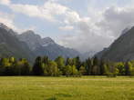
Vrata (which means Door) is a glacier valley cut in at the base of the majestic Triglav North Face. Even with our feet firmly on the flat gravel terrain, just looking up towards the sky and the mighty summit of Triglav can make one dizzy. The skypiercing summits of Cmir, Triglav, Bovski Gamsovec, Stenar, Dolkova Spica, Skrlatica, Rokavi, Dovski kriz, Skrnatarica and Kukova spica tower above Vrata like sentinels, protecting the valley which quietly sleeping under the velvety green carpet of forests, only interrupted by an occasional pasture. The valley flood covered in sediments, moraines, river pebbles and gravel sliding down from the slopes above is cut in two by the energetic Triglavska Bistrica River, which receives all the waters of the area, including the Pericnik Fall and drains them into the Sava River. The Vrata Valley is more than a natural phenomenon. In the past, its inhabitants were chiefly engaged in pasture farming, forestry and charcoal making. Since the end of the 19th century, Vrata has been a popular hiking, mountaineering and tourist destination. Nowhere else in the park can one feel so strongly the dramatic presence of Triglav and no other valley in the park provides a mountaineer with so many diverse and attractive possibilities.
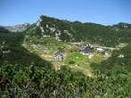
Dom na Komni Mountain Hut (1520 metres) is situated in the eastern edge of plateau Komna, which is sweeping steeply into the Bohinj valley. You can expect for about 2 hours and 15 minutes walking. The best way is that we leave the car in the parking place by Home Savica. The signpost leads us ahead to the road. In the right side we will see log cabin, which is a starting-point for the visit of Savica Waterfall. The way goes roundabout in the forest, which cools us in the summer time. Between that we rarely see the places with a good view of the Bohinj lake. At the end of the path is becoming more and more rocky. The mountain hut was built in the year 1936 and several times renovated and modernized. There also leads telpher line. This place is one of the most visited, because it stands in the waypost of bigger mountain paths. It is supplied all the year and it is managed from Ljubljana-Matica. It has a place with outside terrace, which offers wonderful views to the lake in the valley. Only 15 minutes is from this hut to the hut under Bogatin.

Dom Planika pod Triglavom (2401) Mountain Hut is situated in the southern side of Triglav. It lies on the high plateau Ledine in Julian Alps. The first hut was built in the year 1871, but it fell in ruins some years later. It was named Triglav tempelj (Triglav temple). In the year 1877 they built the new hut and renovated it three years later. In the year 1911 they opened beside the hut the new hut called Dom Marije Terezije. After the First World War the hut took over the Slovenian mountain association. It was changed to the frontier guardhouse. After the Second World War was the hut took over by the Mountain assosiation Gorje and the mountain hut got the present name. In the year 1987 was the mountain hut demolished and they built a new dependency in the year 1992. Dom Planika pod Triglavom is open from the end of June to the end of September. They have two places for eating, on two common beds is 41 beds and in 10 rooms is 82 beds. From the mountain hut to the peak of Triglav (2864 m) is about one hour and half of walking across the Mali Triglav or by the pretentious road over the Triglav skrbina. From the mountain hut is a nice view to the surroundings.

Fort Hermann is part of the stronghold complex of the Kluze Fortress. It was built in the rising ground above the Kluze Fortress. The beginning of the trail is in the nearness of the Kluze Fortress, at the opposite side of the road. Under the steep walls, where the rocks can fall, you will come to the tunnel. The tunnel has lighting and when you walk through, are by side the corridors, which lead to the shooting lines. They started to built the tunnel and the accessible road already in the year 1897. The work was done under the Austrian imperial – royal military construction leadership, which had seat in Bovec and was ended till the year 1906. The tunnel was in The First World War equipped with the three hidden lines, which are still seen now. To the Fort Hermann leaded also the steep trail on the transversal wedges. Today is the trail to the fortress directed with signboards. When you come to the Fort Hermann, you will stop breathing because of its greatness, in spite of that it is very ruined of the passed time. It got the name after the captain Johann Hermann von Hermannsdorf. He was the commander of the Predel fortress in the time of the Napoleon wars. It was built in the year 1900, so that it would support the Kluze Fortress. It was one of the six Carinthia's fortresses. It is also known as the upper Kluze Fortress. The fortresses were protecting the access to Trbiz and to the hinterland of the Austria. In the First World War the Fort Hermann was destroyed by the first greater Italian bombardment and it was not in use till today. You can only see the ruins of the building. In the fortress is standing the information table. You can go by the new stairs to three galleries below Fort Hermann.
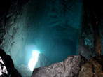
Source of the river Soca in situated in the Trenta valley (Zadnja Trenta). It belongs under community of Bovec. Under the first world war was valley the scene of a lot of battles. River Soca is 137 kilometres long river in north Italy and west Slovenia. It is also named Emerald River because of its wonderful crystal green colour. To visit the source of the river is best to begin in market path from Hut by source Soca which is the mountain post in Trenta. It is most easier approachable from the local road over mountain pass Vrsic. The hut was in the year 1953 reorganized from military building and was later renovated and expanded. It is open from beginning of May till end of October. To see the sight will take you about twenty minutes. The footpath is in good order and in upper part secured with wedges. It is suitable for visitors with proper shoes, but not recommended for children and olders, because of sliping. Karstic source is popular tourist point and it is most beautiful in spring and summer time. Waters in the height 1100 metres highly boil up on day from cave with underworld small lake and through narrow gorge, which is soon broaden. Beside source of the river Soca also begins 20 kilometres long educational footpath. The river flows against south and near Trst in Italy falls into the Adriatic Sea. Snita is the old name for river Soca.

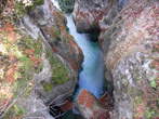
The Mostnica Gorge is situated in the Alpine valley Voje, which lies northeast of the Lake Bohinj near the village Stara Fuzina. The river beds are approximately two kilometre long gorge, which was excavated by the brook Mostnica. The Mostnica Gorge is on some places very narrow, only one metre. The most deep is by the Devil's Bridge, about 20 metres. The Devil's Bridge was built in the year 1777 by baron Ziga Zois for easier supply with charcoal and iron ore from nearby hills. The bridge from carved stone is remarkable constructional work, because it was built in one arch above the steep gorge of the brook Mostnica. The most interesting things in the Mostnica Gorge are the rock in the shape of the small elephant and the many bridges. For the entrance to the gorge we have to pay the entrance fee in the summer time. The path goes by both sides of the gorge, so we can do the round trip.
Kranjska Gora is the largest town and center of the Upper Sava Valley. It is an important mountain tourist destination and a world-renowned winter sports center, mainly because of the annual Vitranc Alpine Skiing World Cup competitions. It is also known for its ski flights and ski jumps in the Planica Valley. The history of Kranjska Gora began in the middle of the 14th century, when they started deforestation and turned the forest into agricultural lands and pastures for cattle and sheep. Until then, the upper part of the Sava Dolinka had been scarcely populated. From a strategic point of view, Kranjska Gora became important during World War I, when Russian prisoners built a military road across the Vršič Pass into the Soča Valley. As a tourist center, it gained a reputation with the construction of the Ljubljana-Rateče-Trbiž railway line in 1870. The connection was discontinued in 1966. Tourism first developed in Kranjska Gora during the summer , with an emphasis on mountaineering and hiking. Recently, a new tourist part of the village with accommodation, recreational facilities and a shopping center has been created around the old village core.


The military cemetery of the fallen soldiers in the World War I is marked with the table and is situated near main road to Log pod Mangrtom. Near the cemetery is a small chapel. At the World War I Military Cemetery is in four terraces buried 859 Austo – Hungarian soldiers, fallen in the fights in Rombon and Cukel. In the middle of the of the cemetery is erected the monument of the fallen soldiers with the image of the Bosnian and Austrian soldiers. The monument was made by Ladislav Kofranek from Prague. The tombstones are separated with iron crosses and Islamic tombstone symbols.
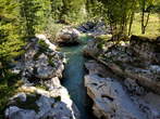
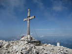
Mangart is 2679 meters high mountain in Julian Alps. It is the fourth highest mountain in Slovenia. It lies on the border with Italy, so it attracts many mountaineers from both countries. The starting point to Mangart is the Mangart Saddle, which is situated on the 2055 meters above sea level. Up to there will drive you the picturesque former military road, which was built in the year 1938. In the saddle is the mountain hut, where they have delicious Slovenian food. It is open from July till September. The Mangart Saddle is a popular place for gliding parachutists. From there we can see Mangrt Lake. There are two main paths to the Mangart, Italian and Slovenian Way. Italian Path is gently sloping, easier and it takes about two hours. Slovenian Path goes by western wall and it is more difficult. It takes about one hour and half. It is necessary that we have helmet and other proper equipment. Mangart is famous by geological and botanical specialities. It is the only habitant for some rare plants. From the spacious summit is the unforgettable view to Julian Alps with neighbourhood places like Trbiz, Log pod Mangartom, Predil and Lake Valley with Lake Predil (Lake Raibl).

Mangart is 2679 metres high mountain in Julian Alps. It is the fourth highest mountain in Slovenia. It lies on the border with Italy, so it attracts many mountaineers from both countries. The starting point to Mangart is the Mangart Saddle, which is situated on the 2055 meters above sea level. There is no special parking place, but we can park cars on many places along the road where is enough space. Up to there goes the picturesque former military road, which was built in the year 1938. The road is steep, winding and in some parts little exposed. We drive through several tunnels. Driving on this road is a wonderful experience. On the way we can stop on resting places. On the saddle is the mountain hut, where you can get delicious Slovenian food. It is open from July till the end of September. Koca na Mangrtskem sedlu Mountain Hut was opened in the year 1938. The Mangart Saddle is a popular place for gliding parachutists. It is possible to see Mangart Lakes from the Mangart Saddle. We can see Mangart Lake. There are two main paths to the Mangart, Italian and Slovenian Way. Italian Path is gently sloping, easier and it takes about two hours. Slovenian Path goes by western wall, it is more difficult and it takes about one hour and half.


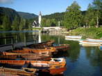
Ribcev Laz is a village in the Bohinj municipality. It is situated in the eastern part of Bohinj and represents the centre of the happening and the most known image of Bohinj. The inhabitants were primary farmers, but today is the main income from tourism. During First World War was the transitional zone between battlefield and hinterland. In Ribcev Laz are the greatest remarkablenesses the John the Baptist's Church, which is today under the memorial protection, the monument to four courageous men, which was erected in the year 1978 and the statue of Goldenhorn. The particularity is the stony wall, which is situated near the inn Pod skalco and is perforated from the sea shells. This proves that the bank of the former sea was very shallow. In Ribcev Laz are the Tourist information centre, shop, post, hotel Bohinj, hotel Jezero, holiday home Na skalci, apartments, restaurants and other. There are available many sport activities as climbing in the natural walls Pod skalco and Bellevue, boating with the borrowing of kayaks and canues, swimming, cycling, walking and other. We can drive with the tourist boats Bohinj and Zlatorog. They also organize evening nights by home made food and accordion.
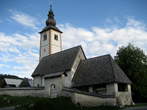
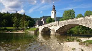
John the Baptist's Church is situated in Ribcev Laz. It is one of the largest remarkablenesses of the place, beside the monument to four courageous men, which was erected in 1987 and the statue of Goldenhorn. It lies by the Lake Bohinj and is together with the bridge the wonderful image of Bohinj. Beside the church is a smaller parking place. The John the Baptist's Church was already made before the year 1300. It got the name by the religious leader from the first century. The church is an important cultural and historical memorial. The building is made from different styles from romanticism to baroque and is under the memorial protection. The most interesting is the head of Janez Krstnik, which is from the year 1380. Today is in the Institution for protection of natural and cultural heritage. The oldest are the frescoes from the 14th century. The belfry and the entrance shed were added to the church in the 18th century. In different stratums were in the southern side painted three Saint Christophers. The speciality of church is the shingled roof and the baroque belfry with double onion and lantern. In the church are three wooden altars from different periods of 17th century. They found in the region of the John the Baptist's Church the archaeological finds from the 1st till 5th century.
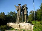
Ribcev Laz is a village in the Bohinj municipality. It is situated in the eastern part of Bohinj and represents the centre of the happening and the most known image of Bohinj. The inhabitants were primary farmers, but today is the main income from tourism. During First World War was the transitional zone between battlefield and hinterland. In Ribcev Laz are the greatest remarkablenesses the John the Baptist's Church, which is today under the memorial protection, the monument to four courageous men, which was erected in the year 1978 and the statue of Goldenhorn. At Ribcev Laz is also a stony wall, which is situated near the inn Pod skalco and is perforated from the sea shells. This proves that the bank of the former sea was very shallow. In Ribcev Laz are the Tourist information centre, shop, post, Hotel Bohinj, Hotel Jezero, holiday home Na skalci, apartments, restaurants and other. There are available many sport activities as climbing on the natural walls Pod skalco and Bellevue, boating with the borrowing of kayaks and canues, swimming, cycling, walking and other. We can drive with the tourist boats Bohinj and Zlatorog. They also organize evening nights by home made food and accordion.

At the end of the Voje valley are situated three waterfalls of Mostnica, which are falling over the interesting limy wall. If we also want to see the Mostnica Gorge it is best that we start the way from the parking place in the village Stara Fuzina. We can shorten the walk, if we park by the Planinska koca na Vojah Mountain Hut. The marked path leads us from here through all the Voje valley. The easy walking way lasts about one hour. The Mostnice Waterfall is located near the refreshment room Slap, where we can relax and enjoy in the beautiful views. The largest waterfall is the middle waterfall, which is called Waterfall Mostnice or Waterfall Voje and it is about 20 metres high and falls to the wonderful greenish pool. From here the water flows to the 5 metres high waterfall called Konjski rep. Just above the Mostnice Waterfall is the first waterfall, which is also 5 metres high. Above the all waterfalls is the slide waterfall, which is 15 metres high and flows on the mossy carpet.

The Savica Waterfall is a wonderful waterfall in Bohinj valley. The best way to come to the waterfall is from the parking place by Koca pri Savici and Home Savica. We come there from Ukanc. Passing the Home Savica we follow the information sighns to the stony bridge over the Mala (Little) Savica. Here we pay in the wooden cottage contribution for maintenance of the road and we can also buy souvenirs. After that we continue the way after the stony stairs to the small wooden hut. Time of walking is about 20 minutes. In the cottage is a view to the Savica Waterfall, Bohinj and Vogel. Waterfall Savica is most visited and very well known Slovenian waterfall. The largest stream is in spring and autumn. The waterfall had celebrated in the poems the greatest Slovenian poet, France Preseren. Waterfall Savica is two part waterfall, which is in the shape of letter A. The smaller waterfall falls in the pool 25 metres deep. The height of the bigger side is about 78 metres. The Savica brook has two parts, which are Mala (Little) Savica and Velika (Great) Savica, on which is the Savica Waterfall. We can come to the waterfall also, if we turn right by the Koca pri Savici, but from this side is not so marvellous view.
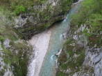
Tolmin is the central point of the Tolmin landscape. It is situated on the balcony between rivers Tolminka and Soca. The city was between first world war, when in the nearness were taking place Soca fronts, very much demolished. In this place are the most remarkable river beds of Tolminka and Zadlascica. Tolmin river beds are the most southern entrance point to Triglav National Park, which is the only Slovenian national park. The road goes from Tolmin and one kilometre to Zatolmin. Tolmin gorge is the most important natural remarkableness. Tourist paths were built from the years 1953 to 1958. They go along Tolminka to the thermal spring and by Zadlascica to Bear’s Head. The main keeper of the road is the Tourist association Tolmin. On the entrance point visitors can buy admission ticket, receive the map of the road and all other important information. The circular trail goes to the confluence Zadlascica and Tolminka, from there to Bear’s Head, by the road Zatolmin – Cadrg to the entrance into Dante’s or Zadlaska Cave. The cave is named by the village Zadlaz. The other name got by the poet Dante Alighieri who perhaps in the beginning of the 14th century visited the cave and in this environment found the inspiration for The Hell in his poem Divine comedy. The Bear's Head is called the natural bridge, the large rock, which had over the centuries wedged between the walls of the canyon Zadlascica. You can return by the road and go across the Devil's Bridge, which was built in the year 1907. At the beginning was wooden, but later was exchanged with iron construction. From this place is a beautiful view to the Tolmin gorge, which was through the centuries shaped by the river Tolminka.
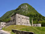
Kluze Fortress is situated near Bovec. It belongs to the most powerful and most interesting strongholds. It is lying above the deep gorge of the Koritnica River, in its most narrow part. Before the Kluze Fortress is a small park, where are also the information tables. The primary Venetian fortress was erected in the second part of the 15th century for defence before the Turks. The Venetians were banished away in the year 1509 and the Kluze fortress came into the Austrian possession. It was strengthen at the expense of the Carinthia provincial States and it became the seat of the district. In the second part of the 17th century the governor general of a province Georg Filip von Gera took care for the necessary improvement and completed it. The Kluze Fortress played the important role in the French wars. It was burnt down and destroyed in the year 1797. In the years from the 1881 to 1882 the remains were pulled down and they built the new fortress in the same place. Between the First World War was here the seat of the Austro – Hungarian garrision close behind the front line. After the Second World War it lost its rule and was left to the time. Between the years 1987 and 1991 they protected the roof construction and put in order the surroundings. Inside of the fortress is presented the history of the fortress and its surroundings, the smaller tourist office, wedding hall and local painting gallery. They regularly perform the games of soldiers, which are dressed in uniforms and with the equipment from the period of the First World War. Before the fortress in the direction of Bovec you can see The Castle Well from the year 1670, which is cut in the rocks. In the well was flowing the rainwater. Before that they carried the water from Koritnica River.
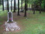

Ukanc is a village in the Bohinj municipality. It is situated in the western side of the Bohinj Lake. In this part are Bohinj – Zlatorog Camp and pier for tourist boat, Hotel Zlatorog, Villa Zlatorog, holiday cottages, pizzeria and spaghetteria, the 1st World War Military Cemetery, the cable car to Vogel and other. Around the Bohinj Lake are many footpaths. In this part is the bridge over the brook Savica, which has beautiful green colour. The brook has two sources, which are Mala and Velika Savica. On the Velika Savica is the Savica Waterfall, which is one of the most beautiful and most visited waterfalls in Slovenia. Mala Savica has a torrential character. Mala and Velika Savica are united near the mountain post Koca pri Savici. From here on is called Savica and before the outfall in Bohinj Lake is joining it also the brook Ukanska Suha.

During the 1st World War was Bohinj the transitional zone between battlefield and hinterland. It was the rallying point for soldiers, training and resting place for sick and wounded. In Bohinj were three military cemeteries, from which are now maintained the cemeteries on Rebro and in Ukanc. The cemetery in Ukanc is situated by the road Zlatorog – Savica, near the lower station of cable car for Vogel. In the cemetery are 282 graves of fallen soldiers in Krn mountains and deceased in the Ukanc region. The military cemetery is surrounded with wooden fence. The graves are concrete with wooden crosses. In the cemetery we can also see the wooden chapel with the stairs from natural stone, memorial board in Hungarian language and the monument dedicated to heroes of Krn – Defenders of Bohinj.

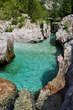

Visevnik (2050) is a mountain in Pokljuka plateau. It is one of the highest peaks in crest which separates Pokljuka plateau from valley Krma. Steep slope lasts two hours and we make 700 metre height about sea level, so that mountain sticks and good boots want be superfluous. It is the best that we park car near barracks in Rudno field in Pokljuka, from where we arrive from Bled, it is about 20 kilometres. Board with inscription Triglav direct us towards the road to military ski slope. At lower station ski lift we go direct to the right and we rise by ski slope to the top of ski lift. Close to top we come to small flat land called Zlate vode where we can have short rest and enjoy in peace and silence. Through rare wood we go to the ridge, which sweep from Viševnik. We follow it and then go left to the top from where we have wonderful view to Pokljuka and Bohinj mountains, Triglav and tops around it. Slope to Viševnik is the best in late spring, in summer we have to watch the sun burns.

Vogel is situated in Bohinj Commune. It lies in the southeast of the Julian Alps. It is a ski slope in the region of Triglav National Park. Contemporary cable railway in the Ukanc takes us to the 1537 heigh above sea level. From restaurant Viharnik, which is just near getting out of the cable railway, it is a wonderful panorama view to the Bohinj valley. They have pizza and other food. Here is also a famous Ski Hotel Vogel, where guests can enjoy in the sauna, restaurant, appetiser drink, sunny terace and views to Bohinj lake, Triglav or to the ski slopes Vogel, Sija, Rodica. We can go to Vogel in the winter and also in the summer months. Winter season lasts from the end of October till December and if there is a lot of snow, till Easter. The cable railway works from 8 a.m. to 6 p.m., every half hour. Ski gears work from 9 a.m. to 4 p.m. In transitive months among the winter and the summer season and other way, it comes to the changes of working time. There is for 38 kilometres ski slopes, suitable for beginners and demanding skiers. They also organize ski school, they have kindergarten, Elan snowboard park and other activities. Restaurant Orel heads is situated in lower station of ski chair lift Sija, just next to ski slope. It is open in summer and in winter season. They serve you with food for different tastes. In new Alpine village are mountain hut, pizza restaurant, tourist rooms, hostel and apartment house. Vogel is starting-point for easier and demanding tours.

Voje is the Alpine valley, which is situated in the Triglav National Park. We can come to the valley from the village Stara Fuzina in Bohinj. We can drive with the car only to the Planinska koca na Vojah Mountain Hut and then we have to walk. We can aslo leave the car on the parking place by the village Stara Fuzina. Through the Voje valley flows the mountain brook Mostnica and goes the forest road, which leads us over the meadows and past many small weekend houses. In the neighbourhood of the Voje valley we can see the Mostnica Gorge, Kropa Spring and the Mostnice Waterfall. We can strengthen and relax in the Planinska koca na Vojah Mountain Hut and in the refreshment room Slap, which is situated at the end of the valley near the Mostnica Waterfall. The easy walking by the unpresuming ground lasts about one hour.

Mountain pass Vrsic (1611 m) is the highest road passing in the Eastern Julian Alps. The pass is connecting Savska and Soska dolina or Gorenjska Region with Trenta. Vrsic is considerable part of the year closed because of the snow. The road was built by Russian prisoners between First World War. At that time Vrsic was strategically important, because it made the Austrian army the easier access to the Soska front and it has to be transportable also in the winter months. To Russian army prisoners, victims of the snowslide, reminds the Russian small chapel above the road between the Miha hut and Hut on the wood. The Russian chapel is here as a reminder and as a memory to the absurdity of the world wars. Vrsic is a starting point for mountain tours to Mojstrovka or Prisojnik and for walks in the nearness surroundings. Between walkings you can be attentive to the rocky face of the Pagan girl, which is the best seen from the belvedere hill and to the large window in the wall of the Prisank. The large window is the most known natural window in the Julian Alps and it is one of the largest natural openings in Slovenia. It is high about 80 metres and wide about 40 metres. The crockery should be opened at the breaking and so it sprang up the landslide, which was with the mouldering increasing to the present hole. In Vrsic you can strengthen with home made food in the next mountain huts: Erjavec hut (1515 m), Ticar hut (1620 m), Hut in the Wood (1226 m) and Postman hut (1725 m).
Natural Sights/Attractions
Beaches
Caves
Gorges
Karavanken
Lakes
NP Triglav
Parks
Rivers
Sources
Waterfalls
Cultural-Historical Sights/Attractions
Basilicas
Castles
Cemeteries
Cities
Monasteries
Monuments
Museums
Old Towns
Town Halls
Other
Camps
Places for Wedding
Ports
Ski Slopes
Spas
Toboggan Runs