 KRAJI - Slovenia


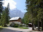
 | Lake Jasna |
 | Vrsic |
 | Triglav |
 | Vitranc |
 | Triglav North Face |
 | Martuljek Waterfalls |
 | Vrata Valley |


Walking Trail: Krma-Dom Planika pod Triglavom Mountain Hut 

Today
13 33
Tomorrow
14 35
29.06.2026
15 34


Walking Trail: Krma-Dom Planika pod Triglavom Mountain Hut
Photo: 236-0

Parking places in the last part of Krma Valley
Photo: 236-1

House at the start
Photo: 236-2

Slightly sloping path at start
Photo: 236-3

Path through the forest from Krma
Photo: 236-4

Krma Valley
Photo: 236-5

Small meadov with a view on Vernar summit
Photo: 236-6
")
Vernar (2225 m)
Photo: 236-7

Pass Bohinjska vratca to the Vodnikov dom Mountain Hut
Photo: 236-8

Kurica
Photo: 236-9

Upper Krma
Photo: 236-10

Trough along the way in Upper Krma
Photo: 236-11

View of Upper Krma and pastoral home Prgarca
Photo: 236-12
")
Kurica on the way to Konjski preval (Horse Pass)
Photo: 236-13

Slope to the pass
Photo: 236-14

Marked path Krma - Dom Planika pod Triglavom Mountain Hut
Photo: 236-15

Kurica near the pass
Photo: 236-16

View of Upper Krma
Photo: 236-17

Tosc, Veliki Draski vrh and other peaks above Krma Valley
Photo: 236-18

View of Triglav
Photo: 236-19

Gently sloping path to the Konjski preval with a view of Triglav
Photo: 236-20

Path to the Konjski preval
Photo: 236-21
")
Konjski preval (2020 m)
Photo: 236-22
")
Miselj vrh Peak (2350 m)
Photo: 236-23

Konjski preval with a view of the peaks eastern from Triglav
Photo: 236-24

Konjski preval from the path to the Dom Planika pod Triglavom Mountain Hut
Photo: 236-25

Path to the Vodnikov dom Mountain Hut and Spodnje bohinjske gore
Photo: 236-26

Vodnikov dom Mountatin Hut
Photo: 236-27

Slope to the Dom Planika pod Triglavom Mountain Hut
Photo: 236-28

Zigzak path to the Dom Planika pod Triglavom Mountain Hut
Photo: 236-29

Mountains above Velska dolina
Photo: 236-30

Last part of the path to the Dom Planika pod Triglavom Mountain Hut
Photo: 236-31

View of Triglav near arrival to Dom Planika pod Triglavom Mountain Hut
Photo: 236-32
Data
Municipality: KRANJSKA GORA (5212 population)
Settlements in the municipality:
Kranjska Gora (1491 population), Mojstrana (1098), Gozd Martuljek (636), Dovje (620), Rateče (618),
Podkoren (390), Belca (161), Log (95), Zgornja Radovna (71), Srednji Vrh (32)


