 KRAJI - Slovenia


 | Triglav |
 | Vrsic |
 | Lake Jasna |
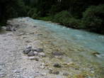
 | Krnica |
 | Triglavska Bistrica Trail |
 | Cycle route: Kranjska Gora-Mojstrana |
 | Planica Nordic Centre |


| Triglav |
| Vrsic |
| Lake Jasna |
| Krnica |
| Triglavska Bistrica Trail |
| Cycle route: Kranjska Gora-Mojstrana |
| Planica Nordic Centre |
Photo: 200150-0
Photo: 200150-1
Photo: 200150-2
Photo: 200150-3
Photo: 200150-4
Photo: 200150-5
Photo: 200150-6
Photo: 200150-7
Photo: 200150-8
Photo: 200150-9
Photo: 200150-10
Photo: 200150-11
Photo: 200150-12
Photo: 200150-13
Photo: 200150-14
Photo: 200150-15
Photo: 200150-16
Photo: 200150-17
Photo: 200150-18
Photo: 200150-19
Photo: 200150-20
Photo: 200150-21
Municipality: KRANJSKA GORA (5212 population)
Settlements in the municipality:
Kranjska Gora (1491 population), Mojstrana (1098), Gozd Martuljek (636), Dovje (620), Rateče (618),
Podkoren (390), Belca (161), Log (95), Zgornja Radovna (71), Srednji Vrh (32)


 at the start of the path, direction signs for the hiking paths and cycling paths")


