 KRAJI - Slovenia


 | Triglav |
 | Vrsic |
 | Lake Jasna |
 | Krnica |
 | Planica - Tamar Valley |
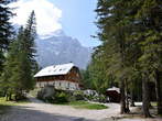 | Vrata Valley |
 | Vitranc |


| Triglav |
| Vrsic |
| Lake Jasna |
| Krnica |
| Planica - Tamar Valley |
| Vrata Valley |
| Vitranc |
Photo: 220025-0
Photo: 220025-1
Photo: 220025-2
Photo: 220025-3
Photo: 220025-4
Photo: 220025-5
Photo: 220025-6
Photo: 220025-7
Photo: 220025-8
Photo: 220025-9
Photo: 220025-10
Photo: 220025-11
Photo: 220025-12
Photo: 220025-13
Photo: 220025-14
Photo: 220025-15
Photo: 220025-16
Municipality: KRANJSKA GORA (5212 population)
Settlements in the municipality:
Kranjska Gora (1491 population), Mojstrana (1098), Gozd Martuljek (636), Dovje (620), Rateče (618),
Podkoren (390), Belca (161), Log (95), Zgornja Radovna (71), Srednji Vrh (32)


