 KRAJI - Slovenia


 | Triglav |
 | Lake Jasna |
 | Vrsic |
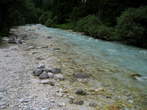 | Triglavska Bistrica Trail |
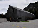 | Slovenian Alpine Museum |
 | Dom Planika pod Triglavom Mountain Hut |
 | Vitranc |


| Triglav |
| Lake Jasna |
| Vrsic |
| Triglavska Bistrica Trail |
| Slovenian Alpine Museum |
| Dom Planika pod Triglavom Mountain Hut |
| Vitranc |
Photo: 220020-0
Photo: 220020-1
Photo: 220020-2
Photo: 220020-3
Photo: 220020-4
Photo: 220020-5
Photo: 220020-6
Photo: 220020-7
Photo: 220020-8
Photo: 220020-9
Photo: 220020-10
Photo: 220020-11
Photo: 220020-12
Photo: 220020-13
Photo: 220020-14
Photo: 220020-15
Photo: 220020-16
Photo: 220020-17
Photo: 220020-18
Photo: 220020-19
Photo: 220020-20
Photo: 220020-21
Photo: 220020-22
Photo: 220020-23
Photo: 220020-24
Photo: 220020-25
Municipality: KRANJSKA GORA (5212 population)
Settlements in the municipality:
Kranjska Gora (1491 population), Mojstrana (1098), Gozd Martuljek (636), Dovje (620), Rateče (618),
Podkoren (390), Belca (161), Log (95), Zgornja Radovna (71), Srednji Vrh (32)


