 KRAJI - Slovenia


 | Golica - Koca na Golici Mountain Hut |
 | Stara Sava - Bucelleni - Ruard Manor |
 | Rodine - Janez Jalen's birth-house |
 | Ajdna |
 | Jesenice - Stara Sava (Old Sava) |
 | Pristava and Zois Park |
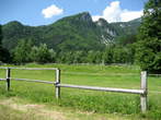
 | Zavrsnica - Lake Zavrsnica |


| Golica - Koca na Golici Mountain Hut |
| Stara Sava - Bucelleni - Ruard Manor |
| Rodine - Janez Jalen's birth-house |
| Ajdna |
| Jesenice - Stara Sava (Old Sava) |
| Pristava and Zois Park |
| Zavrsnica - Lake Zavrsnica |
Photo: 505-0
Photo: 505-1
Photo: 505-2
Photo: 505-3
Photo: 505-4
Photo: 505-5
Photo: 505-6
Photo: 505-7
Photo: 505-8
Photo: 505-9
Photo: 505-10
Photo: 505-11
Photo: 505-12
Photo: 505-13
Photo: 505-14
Photo: 505-15
Photo: 505-16
Photo: 505-17
Photo: 505-18
Photo: 505-19
 Waterfalls around
Distances in brackets are approximate air distances. Street distances can be much longer.
Municipality: JESENICE (20759 population)
Settlements in the municipality:
Jesenice (12926 population), Koroška Bela (2060), Slovenski Javornik (1885), Hrušica (1630), Blejska Dobrava (914),
Planina pod Golico (271), Javorniški Rovt (270), Kočna (240), Lipce (229), Potoki (102), Prihodi (97), Plavški Rovt (77), Podkočna (58)


